Among the regular inter-island routes in the Galápagos, the crossing between Puerto Ayora on Santa Cruz and Puerto Villamil on Isabela has the most consistent reputation for rough water. Travelers who handle the Santa Cruz to San Cristóbal or Floreana routes without difficulty often report a noticeably harder ride on the way to Isabela, with more pounding, more spray, and more cases of seasickness on board.
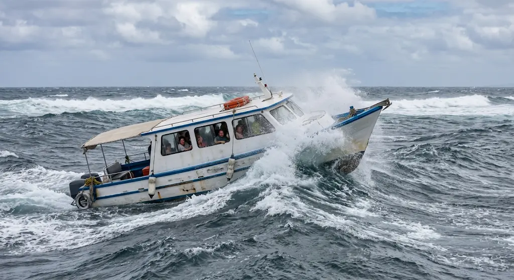
This is not a matter of chance or of a single bad operator. The route combines several physical factors at once: a long stretch of exposed open ocean, a heading that meets the dominant swell at an uncomfortable angle, small high-speed boats with planing hulls, and an arrival through a shallow, reef-lined channel at Puerto Villamil. Each factor would be manageable on its own. Together, they make this crossing the most demanding public sea route most visitors will take in the archipelago.
Understanding these causes helps travelers choose departure times, seats, and travel months more effectively, and sets realistic expectations for a journey of roughly two to two and a half hours.
| Specification | Detail |
|---|---|
| Route | Puerto Ayora (Santa Cruz) to Puerto Villamil (Isabela) |
| Typical crossing time | About 2 to 2.5 hours, longer in heavy swell |
| Vessel type | Fiberglass speedboats (lanchas) with two or three outboard engines |
| Departures | Early morning and mid-afternoon in each direction |
| Main sea condition | Southern and southeastern swell meeting the boat on the beam or quarter |
| Roughest period | Cool season, roughly June to November |
| Calmest period | Warm season, roughly January to April |
| Port authority | Port Captaincy (Ecuadorian Navy) may suspend departures in hazardous conditions |
An Exposed Route Across the Southern Archipelago
Santa Cruz sits near the geographic center of the Galápagos, while Puerto Villamil lies on the southeastern coast of Isabela, the largest island in the group. The two ports are separated by roughly 80 to 90 kilometers of water, and most of that distance runs across open ocean with little shelter from nearby land.
Routes in the central part of the archipelago, such as those passing between Santa Cruz, Santa Fe, and San Cristóbal, still cross open water, but the surrounding islands partly break up wind and waves. The Isabela route instead runs along the southern edge of the island group, where swell generated far away in the South Pacific arrives with almost nothing to slow it down. This exposure is the starting point for everything else that makes the ride uncomfortable. For a broader overview of how each route compares, see the guide to Galápagos inter-island ferry routes.
Swell Direction and the Angle of the Boat
The Galápagos sit within the belt of the southeast trade winds, and the dominant swell in the region tends to come from the south and southeast. During the southern winter, storms in the Southern Ocean also send long-period swell northward that reaches the islands with considerable energy.
Boats heading from Santa Cruz to Isabela travel broadly west to southwest. That heading means the swell usually strikes the vessel from the side or from behind at an angle, a pattern sailors call beam seas or quartering seas. Rather than riding straight over waves bow first, the boat rolls from side to side and yaws as each swell passes underneath. This combination of rolling and pitching is the motion most strongly associated with motion sickness, which explains why passengers often feel worse on this route than on others of similar length.
When local wind blows against the prevailing current, the surface also develops a short, steep chop on top of the longer swell. The result is a layered sea state: a slow, deep roll from the swell and a rapid series of impacts from the chop.
Small Speedboats Built for Speed
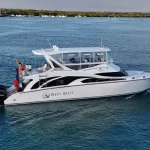
Inter-island transport in the Galápagos relies on fiberglass speedboats, locally called lanchas, typically powered by two or three large outboard engines and carrying a few dozen passengers. Their planing hulls are designed to rise onto the water surface and travel quickly, which keeps crossings to a little over two hours.
The trade-off is comfort. A planing hull at speed does not absorb waves the way a larger displacement vessel would. Instead, it lifts off a crest and drops into the following trough, producing the repeated slamming that passengers feel most strongly at the bow. Captains reduce speed when conditions worsen, which softens the impacts but lengthens the crossing, so the total time in motion increases on precisely the days when the sea is roughest. Seat position matters considerably here, as explained in the guide to the best seats on a Galápagos ferry.
The Reef Channel at Puerto Villamil
The final stage of the crossing adds another variable. Puerto Villamil is approached through a shallow channel bordered by reefs and lava formations, where swell can stack up and break near the entrance. Captains must time their approach to the wave sets and often slow down sharply, which can make the last minutes of the trip feel more unstable than the open-water section.
Tide levels also influence the approach. During periods of strong tidal range and swell, known locally as aguajes, conditions near the entrance can deteriorate enough for authorities to delay or suspend departures. Santa Cruz’s Academy Bay is comparatively sheltered, so the difference between the two ports adds to the perception that Isabela is the harder destination to reach by sea.
How Conditions Change Through the Year and the Day
The archipelago has two broad seasons, and the Isabela crossing reflects both clearly. From June to November, the cool garúa season brings stronger trade winds, cooler water linked to the Humboldt Current, and more frequent southern swell. This is when the route is at its roughest, and when seasickness is most common among passengers.
From January to April, the warm season usually brings lighter winds and flatter seas, although occasional northern swell and afternoon squalls still occur. December and May act as transitional months. A month-by-month breakdown is available in the overview of the worst months for rough seas and tides.
Time of day matters as well. Morning departures typically meet calmer water, since trade winds tend to strengthen during the afternoon as land heats up. Travelers sensitive to motion generally have an easier crossing on the early boat in either direction.
Safety Oversight and Operating Procedures
Departures are supervised by the Port Captaincy, which is part of the Ecuadorian Navy and has authority to cancel or postpone trips when sea conditions are considered dangerous. Operators are required to carry life jackets for every passenger, and crews conduct passenger counts before departure.
Before boarding, luggage passes through biosecurity inspection to prevent the movement of seeds, soil, insects, and other organisms between islands. Bags are generally stowed on deck or in covered compartments, where they can be exposed to spray, so waterproof covers or dry bags are a sensible precaution. In Puerto Ayora, passengers usually reach the boat by water taxi, and on arrival in Isabela visitors pay a municipal entry fee at the dock. Current charges are listed in the guide to water taxi and pier fees.
Reducing Discomfort on the Crossing
Several measures make a measurable difference on this route. The most effective is seat choice: the rear and center of the boat move far less than the bow, and sitting where the horizon is visible helps the brain reconcile visual and balance signals. Eating lightly beforehand, avoiding alcohol the night before, and staying hydrated also help.
Over-the-counter motion sickness medication, such as dimenhydrinate or meclizine, works best when taken 30 to 60 minutes before departure, since it is far less effective once symptoms begin. Travelers with a history of severe motion sickness should consult a doctor beforehand. More detailed advice is collected in the guide to preventing seasickness on Galápagos ferries.
Booking ahead also helps travelers secure the preferred morning departure during busy periods. Tickets for the outbound and return legs are available for Santa Cruz to Isabela and for the reverse direction.
What the Crossing Reveals About Island Travel
The reputation of the Santa Cruz to Isabela route is grounded in oceanography rather than anecdote. Exposure to southern swell, a heading that meets the waves at an awkward angle, fast boats with little capacity to absorb impacts, and a demanding reef entrance combine to produce conditions that differ clearly from the archipelago’s more sheltered central routes.
The crossing also illustrates a broader reality of the Galápagos. These islands lie in an open ocean shaped by converging currents and seasonal wind systems, and the same forces that bring nutrient-rich water and abundant marine life also govern how people move between communities. Public sea transport remains the lifeline connecting Isabela’s residents to supplies, health services, and the rest of the province, which makes the route’s reliability a matter of local importance, not only of visitor comfort.
For travelers, the practical lesson is that preparation outweighs luck. Choosing the morning departure, traveling in the warmer months when possible, sitting toward the stern, and taking preventive medication will turn a notoriously rough crossing into a manageable one that gives access to one of the least developed and most geologically active islands in the archipelago.
Frequently Asked Questions
How long does the ferry from Santa Cruz to Isabela take?
The crossing usually takes about two to two and a half hours. In heavy swell, captains reduce speed and the trip can last longer, particularly during the approach to Puerto Villamil.
Is the morning or afternoon ferry to Isabela calmer?
The morning departure is generally calmer. Trade winds tend to strengthen in the afternoon, which increases surface chop and makes the later crossing rougher in most seasons.
Which months have the roughest seas between Santa Cruz and Isabela?
The cool season, from about June to November, brings stronger winds and more frequent southern swell. July through October are typically the most challenging months on this route.
Where should I sit to avoid seasickness on the Isabela ferry?
The rear and center of the boat experience the least vertical movement. Sitting near the stern with a view of the horizon reduces the mismatch between visual and balance signals that causes motion sickness.
Can the Santa Cruz to Isabela ferry be cancelled due to bad weather?
Yes. The Port Captaincy can suspend or postpone departures when swell or tidal conditions are considered unsafe, especially near the reef entrance at Puerto Villamil. Cancellations are uncommon but more likely during strong swell events.
Do I need to pay a fee when arriving in Isabela by ferry?
Visitors pay a municipal entry fee on arrival at the Puerto Villamil dock, separate from the ferry ticket. A small water taxi charge may also apply at the departure port in Puerto Ayora.