Everything consumed in the Galápagos Islands arrives by sea — cement, diesel, frozen food, vehicle parts — and so does almost everyone moving between the inhabited islands. Roughly 1,000 kilometres of open Pacific separate the province from mainland Ecuador, and that distance has governed settlement, commerce and ecological risk for close to five centuries.
The archipelago’s shipping history falls into four phases: opportunistic anchorage by buccaneers and whaling fleets; a colonial supply line dependent on irregular sailing vessels; a wartime build-out that produced the first real port infrastructure; and today’s regulated system of container ships, cargo barges and licensed passenger speedboats.
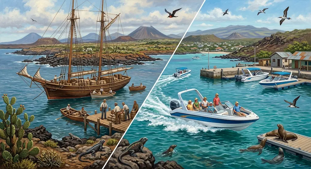
That sequence explains details travellers notice but rarely question — why freighters anchor offshore instead of docking, why no passenger ferry runs from Guayaquil, and why the inter-island crossing is made on a 30-seat fibreglass hull rather than a conventional ferry.
| Specification / Metric | Detail / Value |
|---|---|
| First documented landfall | 1535 — Fray Tomás de Berlanga, blown off course |
| Post Office Bay mail barrel | Installed 1793, Floreana; still informally used |
| Ecuadorian annexation | 12 February 1832 |
| Baltra base construction | Begun 1942; two airstrips, roughly 200 buildings |
| First commercial flight | 1963 to Baltra; scheduled service from 1968 |
| Containerised cargo | Introduced 2015; previously all breakbulk |
| Main cargo route | Guayaquil – San Cristóbal – Santa Cruz – Guayaquil |
| Route distances | Santa Cruz–Isabela 45 nm; –San Cristóbal 43 nm; –Floreana 41 nm |
| Speedboat capacity / duration | Approx. 20–40 passengers; 2 to 2.5 hours |
| Standard departures | Around 06:00–07:00 and 14:00–15:00, daily |
| Regulated tourist fare (2026) | US$50 per person per leg (Resolution MIT-SPTM-2026-0126-R) |
| Protection status | National Park 1959; World Heritage 1978; Marine Reserve 1998 |
Anchorages Before Ports: Tortoises, Whalers and a Barrel on Floreana
For 250 years after Berlanga’s accidental arrival, the archipelago served as a refuge rather than a destination. English and Dutch raiders used sheltered inlets such as Buccaneer Cove to careen hulls and load giant tortoises, which survived months in a ship’s hold without food or water. That single biological trait made the islands strategically valuable long before settlement was attempted.
Whaling fleets formalised the practice. Around 1793 a wooden barrel was placed at Post Office Bay so outbound crews could leave letters for homebound ships — effectively the archipelago’s first maritime service, unmanned and entirely dependent on other vessels’ traffic. The tortoise harvest that sustained those fleets remains the most severe documented human impact on the islands, and shapes the recovery work described in our giant tortoise guide.
Sovereignty Without Infrastructure, 1832–1940
Ecuador annexed the archipelago in February 1832, and José de Villamil founded the first colony on Floreana. Sovereignty produced no infrastructure. Small sailing vessels ran erratically from Guayaquil carrying convicts, colonists and trade goods, returning with dried fish, tortoise oil and orchilla lichen.
Two constraints emerged then and have never disappeared. The islands have almost no deep-water harbours suited to large ships, so cargo has always required transfer at anchor. And freight volumes were too small for dedicated vessels, meaning mixed cargo-passenger ships dominated well into the twentieth century, the same kind that carried Norwegian and German settlers in the 1920s and 1930s.
Base Beta: The Wartime Docks That Changed Everything
The turning point came in 1942, when Ecuador allowed the United States to build an air base on Baltra to protect the Panama Canal approaches. Within months the site had two airstrips and roughly 200 buildings, together with docks, fuel storage and a working water supply — the first industrial-scale port facilities the archipelago had seen.
Its legacy outlasted the war. The base became a civil airport, receiving its first commercial flight in 1963, and Baltra remains the main fuelling point for tourist vessels. A runway was resurfaced in 1968 and mainland flights began, timed at first to serve the earliest tourist ships; the M/V Lina A entered service on 4 December 1969. Aviation absorbed long-distance passenger traffic, leaving shipping with freight and short island hops — the division still described in our guide to travelling between the Galápagos islands.
Breakbulk to Boxes: How Supplies Reach the Islands Now
Freight modernised remarkably late. Container service began only in 2015; before that, all goods moved as breakbulk cargo, craned aboard crate by crate, multiplying handling time, breakage and the risk of stowaway organisms. By the mid-2010s five vessels worked the Guayaquil run, with over 85% of cargo containerised and inspected by the Galápagos Biosecurity Agency.
Discharge remains indirect. Ships anchor at designated areas near the Itabaca Canal and off San Cristóbal, and licensed gabarras — cargo barges operating under a fixed tariff — lighter containers ashore. Fuel arrives by tanker for the Baltra dispatch station. The same barge logic governs the short Itabaca Canal crossing linking the airport road to northern Santa Cruz. Hull inspections, ballast-water rules and SICGAL baggage screening exist because introduced species, not visitor numbers, represent the archipelago’s principal threat — the reasoning behind the entry requirements and mandatory fees.
The Lancha: Engineering Behind the Two-Hour Crossing
What travellers call a ferry is technically a fibreglass speedboat with an enclosed cabin and two or three high-power outboard engines, seating roughly 20 to 40 passengers with no onboard toilet. The design is a compromise: fast enough to complete a crossing in one weather window, light enough for shallow approaches, cheap enough for small operators.
Three routes run out and back — Santa Cruz–Isabela at 45 nautical miles, Santa Cruz–San Cristóbal at 43, Santa Cruz–Floreana at 41, taking two to two and a half hours depending on sea state, with reduced speeds in rougher months. Everything funnels through Puerto Ayora; there is no direct San Cristóbal–Isabela link, a constraint detailed in our inter-island routes guide. Before each departure, Ecuadorian Navy port authorities verify crew papers, instruments and safety equipment. Fares are administratively set rather than market-driven: a 2026 ministerial resolution fixed the tourist fare at US$50 per person per leg, tracked in our 2026–2027 price guide.
The Jessica Grounding and the Limits of the System
Maritime traffic has repeatedly tested the protection framework. On 16 January 2001 the tanker Jessica ran aground at Wreck Bay outside Puerto Baquerizo Moreno with 600 tonnes of diesel and 300 tonnes of intermediate fuel oil aboard. Leakage began days later, and a large share of the roughly 900,000 litres escaped. Currents dispersed much of the slick, but delayed effects were severe: research subsequently linked the spill to mortality above 60% among marine iguanas on nearby Santa Fe, context for our marine iguana guide. Groundings on the mainland run have continued periodically, driving stricter vessel rules, fuel-transfer protocols and the shift to containers across the 138,000 km² Galápagos Marine Reserve.
What This Means for Passengers Today
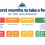
The consequences are practical. No scheduled passenger service exists from the mainland, so flying is the only realistic arrival option. Departures cluster in early morning and mid-afternoon, capacity is finite, and boats sell out in high season. Baggage limits are strict because payload directly affects trim on a small planing hull, as set out in our luggage policy explainer. Conditions vary seasonally: the cooler garúa months from roughly July to December bring stronger swell, so preventive medication before boarding matters more than remedies afterwards — timing and seat position are covered in our seasickness guide.
Final Thoughts
Galápagos shipping is best read as a case study in constrained logistics. A World Heritage archipelago with roughly 33,000 residents and a tourism economy must be supplied across 1,000 kilometres of ocean without importing the biological contamination that ships have carried to islands worldwide for centuries. Every design choice,anchoring offshore, lightering by barge, screening containers, capping vessel numbers — trades efficiency for containment.
That trade-off has historical logic. The buccaneers and whalers who first used these anchorages operated with no oversight at all, and the resulting depletion of tortoise populations still defines the islands’ conservation agenda. Modern regulation is a correction applied to a four-century pattern of extraction by sea. The Jessica grounding showed how narrow the margin remains: one ageing tanker on a routine supply run caused ecological damage measurable years after the visible slick cleared.
The unresolved question is technological. Outboard-powered speedboats burn substantial fuel per passenger-kilometre inside a protected marine reserve, and cargo vessels remain the main vector for invasive species despite improved inspection. Electrification, hull-cleaning standards and better port design are all under discussion, none yet displacing a system whose architecture was set by wartime engineering and post-war aviation. For now, the archipelago still depends on the principle that has held since 1535: whatever arrives, arrives by ship.
FAQ About Maritime Transport in Galápagos
Can I travel from mainland Ecuador to Galápagos by boat?
No scheduled passenger service operates between the mainland and the archipelago. Cargo vessels from Guayaquil do not carry fare-paying passengers, and the crossing takes several days. Flying to Baltra or San Cristóbal is the only practical option.
How long has the inter-island speedboat service existed?
Regular commercial service between the inhabited ports developed from the 1990s and expanded through the 2000s alongside land-based tourism. Earlier inter-island movement relied on fishing boats, private vessels and irregular cargo runs, with no fixed schedules or published fares.
Why do cargo ships not dock directly in Galápagos ports?
Port facilities on the inhabited islands lack the depth and quay infrastructure for large container vessels. Ships anchor at designated areas near the Itabaca Canal and San Cristóbal, and licensed barges transfer containers ashore under a regulated tariff.
What are the distances on the main inter-island routes?
Santa Cruz to Isabela covers about 45 nautical miles (83 km), Santa Cruz to San Cristóbal 43 nautical miles (80 km), and Santa Cruz to Floreana 41 nautical miles (76 km). Crossings normally run two to two and a half hours, longer in rough seas.
What safety checks happen before a speedboat departs?
Navy port authorities inspect crew documentation, navigation instruments and mandatory safety equipment before granting departure clearance. Passengers also pass SICGAL screening of luggage for organic material, which is why check-in opens well ahead of departure, see our port check-in guide.
Which months bring the roughest crossings?
Seas are generally calmer from January to June during the warm season. From roughly July to December, stronger southeast trade winds and larger swell prompt operators to reduce speed, lengthening crossing times noticeably.